


Lot n° 18
Estimation :
2000 - 3000
EUR
Result without fees
Result
: 1 750EUR
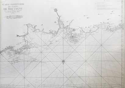
BELLIN. Neptune François. 1st volume. 1753.... - Lot 18 - Pierre Bergé & Associés
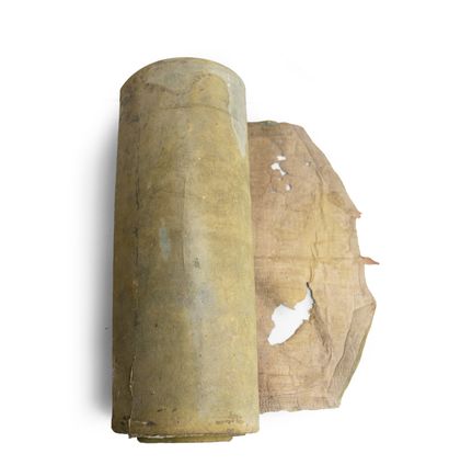
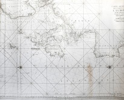
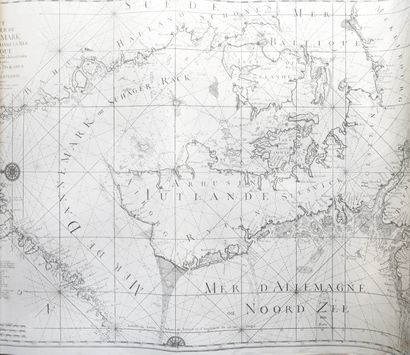
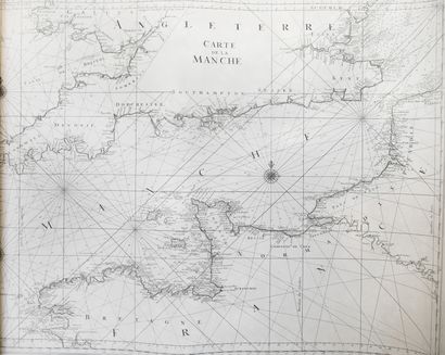
BELLIN. Neptune François. 1st volume. 1753. 1 volume in-folio, stapled, rolled in a period green foxing, with some defects. Copy composed of an engraved title leaf, 4 explanatory leaves, and a scale leaf. This volume includes 30 nautical charts (93 x 64 cm). The table describes only 29 of them, the one of Galicia is not mentioned. This volume includes: "General map of the coasts of Europe on the Ocean, included from Drontherm in Norway, to the Straits of Gibraltar. "Map of the Baltic Sea. " Map of the Danish Sea, and the entrances to the Baltic Sea. " Map of the Straits of Sond. "Map of the Septentrional, or Noord-Zee, Sea, from Bergen and the Islands of Schetland to the Pas de Calais. " Map of the Entrances into the Suyder-Zee and the Embs. " Map of the Entrances of the Meuse and the Scheldt, which includes all the coasts of Zeeland and Flanders. "Map of the Entrance of the Thames, which contains the coasts of England between Clay and Sandwich. "Map of the Sea of Scotland, which includes the northern and western coasts of Scotland, and part of England and Ireland. "General map of Ireland and the western coasts of England. "Particular map of Ireland, containing Galloway Bay and the River Lymerick. The Port of Kinsal is attached. " Map of the English Channel. " Map of the Bay of Biscay. " Particular map of England, which includes the Isle of Wricht, and the Harbour of Portsmouth. "Map of the coasts of France and England in the vicinity of the Pas de Calais. "Map of the coasts of Normandy, from Dieppe to the Pointe de la Percee. "Map from the Pointe de la Perçée to Granville, with the islands of Jersey and Guernsey. "Map of the coast of Brittany, in the vicinity of Saint-Malo. "Map of the vicinity of the islands of Bréhat. "Map of the vicinity of the rivers of Morlaix and S. Pol de Léon. " Map in the vicinity of the Havre d'Abrevrak. " Map of the surroundings of the Bay of Brest. " Map in the vicinity of Port-Louis and the island of Groa. " Map of the surroundings of Morbihan and Belle-Ile. "Map of the vicinity of the entrance to the Loire River. " Map of the Poitou, Aunis... " Map of the coasts of Guyenne, Gascogne... " Map of the northern coasts of Spain... " Map of the western coasts of Spain... Nice atlas of marine maps. A second volume concerning the maps of the Mediterranean, was announced, but never appeared.Revised edition of this Atlas, first published in 1693.
My orders
Sale information
Sales conditions
Return to catalogue