

Lot n° 88
Estimation :
2000 - 3000
EUR
Result with fees
Result
: 2 470EUR
DE FER (Nicolas). Manuscript "Abrégé de Géographie pour l'us - Lot 88
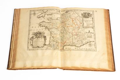
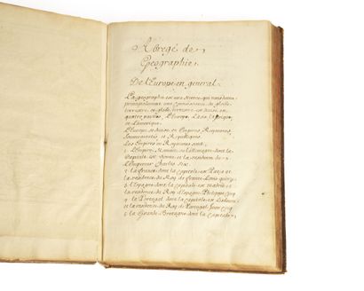
DE FER (Nicolas). Manuscript "Abrégé de Géographie pour l'usage de Monseigneur le Prince Charles de LORRAINE." s.d. Small folio, marbled calf, spine decorated with the Lorraine cross under crown (period binding). Missing headpieces, wear to corners and edges, boards rubbed.
Unpublished manuscript by Nicolas De FER, former engraver of geography maps, and print merchant "dans l'Isle du Palais sur le quay de l'Horloge" à l'enseigne de la Sphère Royale. He was appointed Geographer to the Duke of Burgundy & Dauphin of France, and published several Atlas de géographie and an introduction à la Fortification à l'usage des Enfants de France at the end of the reign of Louis XIV and during the Regency. This atlas includes maps published between 1705 and 1717 for Charles de Lorraine (1712-1780), son of Duke Leopold I and Elisabeth-Charlotte d'Orléans, aka "Mademoiselle de Chartres", probably at the request of the French Court to counterbalance Austrian influence in Lorraine.
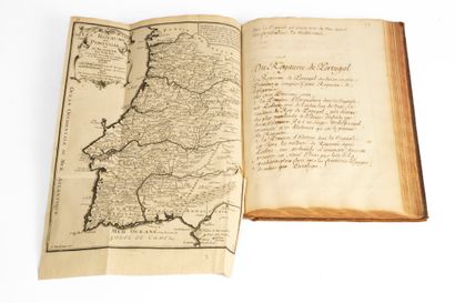
The text details the various regions of European countries and their capitals, starting with Lorraine, and quickly moves on to other parts of the world, following the "new discoveries and observations of Mrs. de l'Académie royale des Sciences" (Asia, Africa and the Americas).
Manuscript comprising 148 pp. of handwritten text with 28 engraved maps, 27 of them double-page, most of them enhanced in color.
PROVENANCE: The arms of the DUC de LORRAINE with crowned cross.
From the Bibliothèque du Président Audiat with armorial bookplate.
My orders
Sale information
Sales conditions
Return to catalogue